
Urbanization in Canada refers to the ongoing demographic shift and spatial transformation as an increasing share of the population concentrates in cities and metropolitan areas, accompanied by the physical expansion of urban built environments and the evolution of economic, social, and infrastructure systems to support higher-density living. By 2026, more than 82 percent of Canadians live in urban centres, making Canada one of the most urbanized nations in the world.
This concentration shapes nearly every facet of Canadian life. Urban regions drive the majority of economic output, house critical infrastructure for energy and transportation, and serve as the testing ground for innovations in sustainability, housing policy, and climate adaptation. The way cities grow determines energy consumption patterns, influences greenhouse gas emissions, and dictates the pace at which communities can transition to low-carbon systems. For professionals in planning, energy management, environmental science, and public policy, understanding urbanization’s mechanics and trajectory is essential for informed decision-making.
The forces behind Canada’s urban growth are multifaceted. Natural population increase, immigration flows heavily concentrated in major metros, and internal migration from rural to urban areas all contribute to expansion. Yet urbanization is not simply about adding more people to city limits. It encompasses changing land use, evolving transportation networks, intensification of existing neighbourhoods, and the emergence of suburban nodes that blur traditional urban-rural boundaries. Different regions experience urbanization in distinct ways: Toronto and Vancouver grapple with density and housing affordability, Calgary and Edmonton balance energy-sector cycles with diversification, while mid-sized cities like Halifax and Saskatoon navigate growth pressures with smaller resource bases.
Looking ahead, urbanization will continue to redefine Canada’s spatial and economic landscape. Climate resilience, energy transitions, digital infrastructure, and equitable access to services will all hinge on how cities adapt to accommodate growth. This article explores what urbanization means in practice, how it unfolds across Canadian regions, the forms it takes, and where current trends are leading the nation’s urban future.
What Urbanization in Canada Means Today
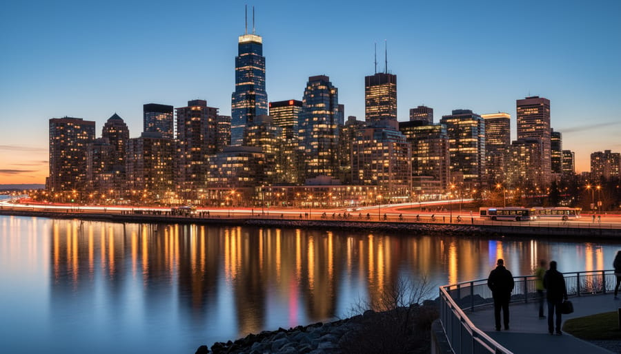
Urbanization in Canada refers to the progressive concentration of the nation’s population in cities and metropolitan regions, a demographic transformation that has fundamentally reshaped where and how Canadians live. At its core, this process describes the increasing proportion of people residing in urban rather than rural areas, combined with the physical expansion of cities into surrounding landscapes. Today, more than 80 percent of Canadians live in urban centers, making Canada one of the most urbanized nations in the world according to Canada goes urban statistics a figure that has climbed steadily over the past century.
The Statistics Canada urban area criteria provides the official framework for understanding what counts as urban in the Canadian context. An urban area must have a minimum population concentration of 1,000 people and a density of at least 400 persons per square kilometer. This technical definition captures the physical reality of urbanization: clusters of humanity living in closer proximity than ever before, supported by concentrated infrastructure and services.
Understanding the terminology helps clarify what we’re actually measuring:
- Urbanization
- The process by which an increasing share of a nation’s population shifts from rural to urban areas, measured as a percentage rather than absolute numbers. This demographic transition reflects migration patterns and differential birth rates between city and countryside.
- Census Metropolitan Areas (CMAs)
- Geographic units defined by Statistics Canada consisting of one or more adjacent municipalities centered on a core population of at least 100,000. CMAs capture the functional economic region around major cities, including suburban communities.
- Urban Growth
- The absolute increase in urban population size, which can occur through natural increase, migration, or boundary expansion. A city can experience urban growth without urbanization if rural populations grow at similar rates.
- Urban Sprawl
- Low-density, automobile-dependent development that extends outward from city centers, consuming agricultural land and natural areas. This pattern characterizes much of Canada’s post-war suburban expansion.
- Densification
- The process of increasing population density within existing urban boundaries through infill development, high-rise construction, and conversion of underutilized sites. This represents an alternative to outward sprawl.
The distinction between urbanization and urban growth matters for policy and planning. Urbanization measures relative shift, the proportion living in cities versus countryside. Urban growth tracks absolute numbers. A country can have high urbanization rates yet slow urban growth if overall population stabilizes, or experience rapid urban growth with minimal urbanization if rural areas also expand quickly. Canada faces both: continuing urbanization as smaller communities lose residents to major centers, and substantial urban growth driven by immigration concentrated in Toronto, Vancouver, and Montreal.
How Urbanization Works in the Canadian Context
Economic Pull Factors
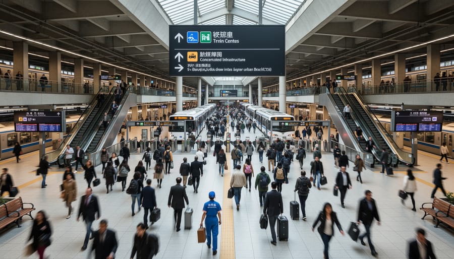
Employment opportunities remain the primary force drawing Canadians to major cities. Toronto, Vancouver, and Calgary consistently offer median incomes 15-25% higher than smaller municipalities, with specialized roles in finance, technology, and professional services commanding premium salaries unavailable elsewhere.
Toronto’s financial district employs over 250,000 people in banking, insurance, and investment management, creating a gravitational pull for finance professionals nationwide. Vancouver’s tech sector has expanded rapidly, with software developer salaries reaching $95,000, $130,000, attracting talent from across British Columbia and beyond. Calgary’s energy headquarters concentrate decision-making roles and executive positions for resource companies operating across Western Canada.
This concentration creates self-reinforcing cycles. As industries cluster, supporting businesses emerge, legal firms, consulting agencies, specialized suppliers, generating additional employment layers. A petroleum engineer relocating to Calgary for a head office role brings family members who fill positions in education, retail, and healthcare, multiplying the initial economic migration.
The wage differential proves decisive for young professionals and skilled immigrants. A nurse in rural Saskatchewan earning $72,000 can command $85,000 in Toronto, while gaining access to specialized practice areas and career advancement unavailable in smaller centers. These economic realities override lifestyle preferences for many workers prioritizing earnings and opportunity.
Immigration and Settlement Patterns
Immigration stands as the single most powerful force accelerating urbanization in Canada, with newcomers overwhelmingly choosing metropolitan areas over smaller communities. Immigrants choose major CMAs at rates far exceeding natural population growth, concentrating settlement in Toronto, Vancouver, and Montreal, cities that collectively absorb roughly 60% of Canada’s annual immigration intake. This preference isn’t arbitrary. These urban corridors offer established ethnic communities that provide social networks, cultural familiarity, and practical support during settlement. They also house the professional services infrastructure newcomers need: language training facilities, credential recognition offices, and multicultural employment agencies.
Federal immigration policy amplifies this pattern by prioritizing economic migrants, skilled workers and entrepreneurs who gravitate toward knowledge-economy hubs where their qualifications align with available opportunities. The result is a self-reinforcing cycle: as immigrant populations grow in major cities, these centers become even more attractive to subsequent waves of newcomers, creating ethnic enclaves with strong economic and social ties. Secondary cities struggle to compete, lacking both the critical mass of established immigrant communities and the diverse employment base that retains newcomers beyond initial settlement.
Infrastructure and Service Concentration
Healthcare facilities in major Canadian cities offer specialized services unavailable in rural areas, transplant units, cancer centers, and research hospitals that draw patients and medical professionals alike. Toronto’s Hospital Row, Vancouver’s Health Sciences Centre, and Montreal’s university hospital networks create medical ecosystems that attract supporting industries, from pharmaceuticals to medical device companies, further concentrating economic activity.
Educational infrastructure follows similar patterns. Universities and colleges cluster in urban centers, bringing tens of thousands of students who often settle permanently after graduation. The University of Toronto alone enrolls over 90,000 students, while McGill, UBC, and other major institutions anchor knowledge economies that spawn startups and research partnerships.
Transit networks, airports, and rail connections make cities logistically superior for business operations and personal mobility. A Vancouver resident can access international flights within 30 minutes; a rural resident might drive three hours. Cultural amenities, theaters, museums, professional sports, diverse restaurants, add quality-of-life advantages that retention-focused employers value when recruiting talent.
These concentrated services create feedback loops: better infrastructure attracts more residents, generating tax revenue that funds further improvements, which draws additional population. Rural areas struggle to maintain even basic services as young professionals migrate cityward, accelerating the urbanization cycle.
Forms of Canadian Urbanization: Patterns Reshaping the Landscape
Metropolitan Concentration
Canada’s three largest Census Metropolitan Areas continue to absorb the majority of the nation’s urban growth, with the Toronto, Montreal, and Vancouver CMAs collectively housing over 35% of the country’s population. Toronto’s CMA alone accounts for nearly 6.5 million residents and has grown by approximately 10% since 2016, driven by both international immigration and interprovincial migration from Atlantic Canada and the Prairies.
This concentration shows no signs of slowing. The Greater Toronto and Hamilton Area (GTHA) exemplifies how metropolitan regions expand beyond traditional municipal boundaries, creating functional economic zones that span multiple cities. Vancouver’s metropolitan footprint now extends from Abbotsford to Whistler along transportation corridors, while Montreal anchors a metropolitan region stretching to Trois-Rivières.
The emergence of mega-regions marks a shift from isolated metropolitan growth to interconnected urban systems. These sprawling urban complexes generate economies of scale in infrastructure, specialized labor markets, and innovation clusters that smaller centers struggle to replicate, reinforcing their gravitational pull on population and investment.
Urban Corridor Development
Urban corridor development represents one of Canada’s most distinctive urbanization patterns, where multiple cities and towns grow along transportation routes until they form continuous or near-continuous urban regions. The Quebec City, Windsor Corridor exemplifies this phenomenon most dramatically. Stretching roughly 1,200 kilometers through southern Ontario and Quebec, this megalopolis contains over 18 million people, more than half of Canada’s population, distributed across interconnected metropolitan areas including Toronto, Montreal, Ottawa, Hamilton, and dozens of smaller municipalities. What distinguishes corridors from simple proximity is their functional integration: shared transportation networks, overlapping economic markets, and commuting patterns that cross municipal boundaries.
British Columbia’s Lower Mainland demonstrates corridor development on a compressed geographic scale, where Vancouver, Surrey, Burnaby, and surrounding municipalities have grown together into a polycentric urban region of 2.7 million residents. The Calgary, Edmonton corridor, spanning 300 kilometers with approximately 4 million people, represents an emerging pattern where two major centers are gradually filling the space between them with residential and industrial development along Highway 2.
These linear patterns create distinct planning challenges. Infrastructure must serve elongated geographies rather than radiating from single centers, requiring coordinated regional governance across jurisdictions that traditionally operated independently.
Suburban Sprawl and Edge Cities
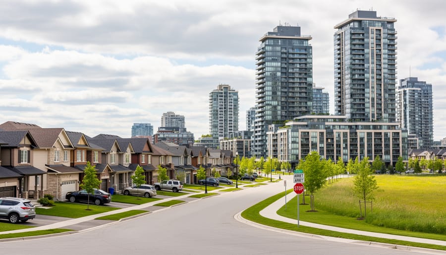
Suburban sprawl represents the horizontal expansion of metropolitan areas across agricultural and undeveloped land, typically characterized by single-family homes, car-dependent infrastructure, and segregated land uses. This pattern has dominated Canadian urban growth since the 1950s, particularly around Toronto, Calgary, and Vancouver, where greenfield development at city edges offered affordable housing but created long-term infrastructure and environmental costs.
Edge cities have emerged as a distinct evolution of sprawl, suburban nodes that function as employment centers rather than purely residential zones. Markham’s technology corridor northeast of Toronto and Mississauga’s airport corporate district exemplify this shift, concentrating office parks, retail complexes, and services in formerly peripheral locations. These centers now compete with traditional downtowns for jobs and investment, reshaping commuting patterns and challenging the monocentric city model.
The sprawl pattern imposes measurable costs: higher per-capita infrastructure expenses for water, roads, and utilities; increased vehicle emissions from longer trip distances; and loss of agricultural land averaging 2,800 hectares annually in the Greater Toronto Area alone. Municipalities increasingly recognize these trade-offs, implementing urban containment boundaries and development charges that reflect true infrastructure costs, though political and market pressures continue to favor low-density expansion in many regions.
Urban Intensification and Densification
Rather than sprawling outward, Canadian cities are increasingly growing upward and inward. Urban intensification focuses development within established boundaries through high-rise construction, mid-rise apartment buildings, and infill projects on underutilized lots. This approach transforms single-family neighbourhoods with townhomes and low-rise condos, converts aging commercial strips into mixed-use corridors, and redevelops brownfield sites.
Provincial growth management policies drive this shift. Ontario’s Growth Plan for the Greater Golden Horseshoe mandates specific density targets for urban centres, while Vancouver’s Broadway Plan rezones entire neighbourhoods for greater height and density. These frameworks respond to agricultural land preservation needs and infrastructure cost realities, servicing sprawl costs municipalities significantly more per capita than intensifying existing areas.
Market forces reinforce policy direction. High land values in established neighbourhoods make dense development financially viable, while younger demographics favour walkable urban living over car-dependent suburbs. Transit-oriented development concentrates density near rapid transit stations, maximizing infrastructure investments. Toronto’s Yonge-Eglinton Centre and Montreal’s Griffintown exemplify this model, packing thousands of new residents into well-serviced nodes that support local businesses and reduce commute times.
How Urbanization Is Applied: Implications Across Canadian Society
Energy Infrastructure and Demand
As urban populations concentrate in Canadian cities, energy infrastructure faces mounting pressure to deliver reliable power to dense residential and commercial cores. A million-person CMA consumes electricity differently than dispersed rural communities: demand surges during predictable peak hours when office towers, transit systems, and apartment buildings all draw simultaneously. This concentrated load pattern strains aging distribution networks designed for lower-density eras, forcing utilities to upgrade transformers, substations, and transmission capacity to prevent brownouts.
Dense urban environments also unlock infrastructure efficiencies impossible in sprawl. District energy systems, centralized plants distributing heating and cooling through underground pipe networks, become economically viable when thousands of buildings cluster within a few square kilometres. Toronto’s Enwave system serves downtown towers this way, cutting individual building energy needs while improving grid flexibility. High urban density similarly enables cost-effective transit electrification: electric bus fleets and expanded rail networks concentrate charging infrastructure at central depots rather than scattering it across hundreds of kilometres.
Urbanization accelerates residential and commercial electrification as well. Urban homeowners adopt heat pumps and electric vehicles at higher rates than rural counterparts, partly because charging stations proliferate faster in cities and partly because dense neighbourhoods justify the infrastructure investment utilities require to support mass adoption.
Housing Markets and Development
Canada’s urban population surge has collided head-on with constrained housing supply, creating affordability crises in Toronto, Vancouver, and increasingly in secondary markets like Ottawa and Hamilton. As migration concentrates in a handful of metropolitan areas, housing demand has consistently outpaced construction capacity, the result of restrictive zoning, lengthy approval processes, and infrastructure bottlenecks that slow development despite strong market signals.
This mismatch manifests differently across urban contexts. In established cores, intensification policies push developers toward high-rise condominiums and mid-rise infill, yet neighbourhood opposition and regulatory complexity often delay projects for years. At urban edges, greenfield subdivision approvals can’t keep pace with household formation rates, while servicing costs for sprawling development strain municipal budgets already stretched by growth pressures.
The development response varies by market maturity. Toronto’s condo boom delivers vertical supply but concentrates units in investor-friendly one-bedrooms, leaving family-sized housing scarce. Vancouver’s geographic constraints and Agricultural Land Reserve boundaries force extreme densification in limited areas. Smaller centres like Kelowna and Halifax face sudden price escalation as urbanization accelerates beyond their historical development pace, lacking the institutional capacity to plan and build at scale.
These dynamics reshape who can afford to live in Canada’s growing cities, driving households toward longer commutes, smaller units, or displacement to more affordable regions, outcomes that compound transportation, equity, and economic productivity challenges as urbanization proceeds.
Transportation Systems and Mobility
As populations concentrate in Canada’s urban centers, transportation systems face mounting pressure to move more people efficiently while reducing environmental impact. Major cities are responding with rapid transit expansion, Toronto’s Ontario Line, Vancouver’s Broadway Subway, and Montreal’s REM represent billions in infrastructure investment aimed at providing alternatives to car dependency.
Yet transit construction struggles to keep pace with population growth. The Greater Toronto Area adds roughly 125,000 residents annually, intensifying congestion on highways and arterial roads. Peak-hour gridlock now costs the Canadian economy an estimated $11 billion yearly in lost productivity, a figure projected to rise as urbanization accelerates.
This tension is driving a fundamental shift in mobility patterns. Cities are reclaiming road space for dedicated bus lanes, protected cycling infrastructure, and pedestrian zones. Toronto’s King Street pilot prioritized streetcars over private vehicles, increasing transit speeds by 25 percent. Vancouver now has over 400 kilometers of bikeways serving a growing share of commuters.
The emerging model integrates multiple modes: commuter rail linking suburban nodes, frequent bus service on arterials, bike-share systems for last-mile connections, and walkable neighborhoods that reduce trip lengths. Success depends on density, concentrated development around transit stations creates the ridership volumes that justify service frequency and operational costs.
Environmental and Resource Management
As Canadian cities densify, their environmental footprints intensify in ways that demand fundamentally different resource management approaches. A concentrated urban population of 25 million consumes vastly more water per square kilometre than dispersed rural communities, straining aging municipal infrastructure built for smaller populations. Toronto processes over 1 billion litres of water daily, while Metro Vancouver handles 1.5 million tonnes of waste annually, volumes that require continuous system expansion and technological upgrades to maintain service levels.
Urban densification creates a paradox: while compact development reduces per-capita land consumption and transportation emissions, it simultaneously concentrates pollution, heat islands, and stormwater runoff in smaller geographical areas. Cities now compete for finite water allocations from surrounding watersheds while managing the ecological disruption caused by impermeable surfaces that prevent natural groundwater recharge.
Green space preservation becomes critical yet increasingly difficult as land values soar. Vancouver has targeted 15 percent tree canopy coverage, but development pressure constantly threatens existing parks and natural corridors that provide essential ecosystem services, flood mitigation, air purification, urban cooling, that engineered systems cannot fully replicate. Climate adaptation compounds these challenges, requiring cities to simultaneously retrofit drainage systems for extreme rainfall events, establish cooling networks for intensifying heat waves, and protect coastal areas from rising water levels, all while accommodating continued population growth within already-stressed environmental boundaries.
Future Cities: Where Canadian Urbanization Is Heading

Demographic Projections and Regional Shifts
Canada’s major Census Metropolitan Areas are projected to absorb the overwhelming majority of population growth through 2035, with the Greater Toronto Area, Metro Vancouver, and Greater Montreal accounting for nearly 60% of national increases. Statistics Canada’s medium-growth scenario forecasts the GTA surpassing 9 million residents by 2035, while Vancouver’s CMA approaches 3.5 million and Montreal reaches 5 million. These concentrations reflect entrenched patterns where economic opportunity, immigration settlement, and quality infrastructure reinforce metropolitan dominance.
Yet a notable shift is emerging in secondary cities. Calgary, Edmonton, Ottawa, and Halifax are experiencing accelerated growth rates that outpace their historical averages, driven partly by affordability pressures pushing residents from Toronto and Vancouver toward markets offering lower housing costs alongside economic diversification. Waterloo Region, Victoria, and Kelowna are witnessing similar dynamics as remote work arrangements expand location options for knowledge workers.
Provincial variations complicate these national trends. Ontario and British Columbia remain urbanization leaders, with over 85% of their populations in urban areas by 2035. The Prairie provinces show divergent paths: Alberta’s cities continue attracting interprovincial migrants, while Saskatchewan and Manitoba experience slower metropolitan concentration. Atlantic Canada faces unique challenges, with urbanization concentrated almost exclusively in Halifax, Moncton, and St. John’s as smaller centers struggle to retain residents against the pull of central Canadian metros.
Technology and Smart City Integration
Digital infrastructure is transforming how Canadian cities manage growth and deliver services. Real-time data networks now monitor traffic flows, energy consumption, and waste collection, allowing municipalities to optimize operations and reduce costs. Toronto’s intelligent transportation systems adjust signal timing based on actual congestion, cutting commute times in peak corridors. Vancouver uses sensor networks to track parking availability and direct drivers efficiently, reducing emissions from circling vehicles.
These systems do more than improve existing services, they’re reshaping where people choose to live and work. High-speed fiber networks and 5G connectivity make remote work viable from smaller cities, potentially slowing concentration in the largest metros. Edmonton’s open data portal lets developers build apps that help residents navigate transit, find services, and report infrastructure issues, making urban life more manageable at larger scales.
Automation in building management, energy distribution, and water systems allows cities to handle growing populations without proportional increases in staffing or infrastructure. Montreal’s automated subway extensions use driverless trains that run more frequently at lower operating costs. Yet these technologies require massive upfront investment and skilled workforces, creating a digital divide where well-resourced cities pull further ahead while smaller centers struggle to compete for talent and residents.
Climate Adaptation and Sustainable Urbanism
Climate change is forcing a fundamental rethink of how Canadian cities develop and where growth occurs. The concentration of population and infrastructure in urban areas creates both vulnerability and opportunity: cities account for roughly 70% of Canada’s greenhouse gas emissions, yet their density makes them ideal laboratories for low-carbon solutions that can’t work at dispersed rural scales.
Extreme weather events are accelerating the shift toward climate-resilient design. After Toronto’s 2013 flooding caused $1 billion in insured damages, municipalities began mandating green infrastructure like permeable pavements and bioswales to manage stormwater rather than relying solely on overtaxed pipe systems. Vancouver now requires all new buildings to meet passive house standards or equivalent performance, cutting heating and cooling energy by 80% compared to conventional construction. These aren’t experimental policies, they’re survival measures as heat domes, atmospheric rivers, and ice storms become routine rather than exceptional.
Carbon-neutral development is moving from aspiration to requirement. Montreal aims to reduce emissions 55% by 2030 through district energy systems that share waste heat between buildings, eliminating individual gas furnaces. Edmonton is planning entire neighbourhoods around transit nodes where car ownership becomes optional rather than mandatory, directly cutting transport emissions that currently represent a quarter of urban carbon footprints.
Environmental pressures are already redirecting growth patterns. Coastal flood risk is pushing development inland in Metro Vancouver, while water scarcity concerns in southern Alberta may constrain Calgary’s sprawl. Cities that integrate climate adaptation early, through building codes, land use rules, and infrastructure investment, will attract the talent and capital that drive economic growth. Those that don’t face mounting costs and declining competitiveness as climate impacts compound.
Canada’s urban transformation isn’t slowing down. By 2035, over 85% of Canadians will live in urban areas, making how we manage this concentration one of the defining challenges, and opportunities, of our generation. The patterns explored throughout this article reveal urbanization as far more than a demographic statistic; it represents a fundamental restructuring of where Canadians work, live, and build their lives.
The mechanisms driving people toward cities remain powerful. Economic opportunity clusters in metropolitan areas. Immigrants choose established urban centers with existing networks. Infrastructure and services follow population density, creating self-reinforcing cycles. Understanding these forces allows policymakers, developers, and communities to anticipate pressures rather than react to crises.
The diversity of urbanization patterns across Canada demands tailored responses. Metropolitan concentration in Toronto and Vancouver requires different strategies than corridor development in Quebec or densification initiatives in mid-sized cities. Sprawl, intensification, and edge city growth each present distinct trade-offs between affordability, sustainability, and livability. No single template works everywhere.
Practical implications cut across every sector examined here. Energy systems must adapt to concentrated demand and enable district-scale solutions. Housing markets need supply mechanisms that match unprecedented urban growth. Transportation networks face the imperative to move more people more efficiently. Environmental management in dense settings becomes critical as ecological footprints concentrate.
The future cities taking shape today will determine Canada’s competitiveness, carbon trajectory, and social cohesion for decades. Technology offers tools for smarter urban operations. Climate adaptation is now a planning requirement, not an option. Demographic shifts will continue favouring urban regions while challenging smaller communities.
Success requires moving beyond reactive development toward strategic urban policy. Proactive infrastructure investment, integrated regional planning, and frameworks that balance growth with sustainability will separate thriving urban regions from those struggling with congestion, unaffordability, and environmental degradation. Canada’s urban future is being written now, in the decisions made at municipal councils, provincial legislatures, and federal ministries. Understanding urbanization equips us to write that future wisely.